21,25€
DeliveryTue, 06 Aug - Thu, 08 Aug
+14,00 €shipping cost - sent from Greece
Skroutz Buyers Protection
Set the delivery location to see products according to your choice.


 AustriaEnglish
 BelgiumEnglish
 BulgariaБългарски
 CroatiaEnglish
 CyprusΕλληνικά
 CzechiaEnglish
 EstoniaEnglish
 FinlandEnglish
 FranceEnglish
 GermanyDeutsch
 GreeceΕλληνικά
 HungaryEnglish
 IrelandEnglish
 ItalyEnglish
 LatviaEnglish
 LithuaniaEnglish
 LuxembourgEnglish
 MaltaEnglish
 NetherlandsEnglish
 PolandEnglish
 PortugalEnglish
 RomaniaRomână
 SlovakiaEnglish
 SloveniaEnglish
 SpainEnglish
 SwedenEnglish
© 20[0-9]{2} Skroutz SA All Rights and Lefts reserved. FAQ | Terms of use | Privacy Policy | Cookie Policy


Skroutz Buyers Protection

Scientific Books


Hobbies & Leisure Books

Hobbies & Leisure Books


Hobbies & Leisure Books

Prices are calculated for:Luxembourg, Other Payment Options
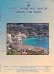
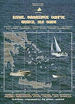
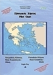
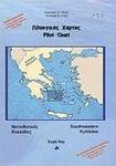
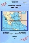
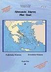
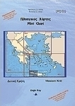
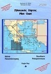
The series of Nautical Charts consists until today of the following maps, in order to cover the Greek area with 23 maps + 3 general ones:
-PC1 Saronic Gulf
-PC2 Eastern Peloponnese
-PC3 Northern Cyclades
-PC4 Southwestern Cyclades
-PC5 Southeastern Cyclades
-PC6 Evvoikos Gulf
-PC7 Corinthian Gulf
-PC8 Patraikos Gulf - Kefalonia
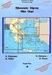
They are enriched with nautical information regarding:
-Dangers, reefs, instructions for narrow passages, shooting fields, etc.
-Currents and their characteristics
-Winds, peculiarities and their frequency, etc.
-Marks for lighthouses, bays, reefs, etc.
-Waypoints
-Official names and local ones
-Protection of anchorages from bad weather conditions
The back side of the map contains:
-The ports and the coasts of the area
-Photos of the ports/bays and the recognition points (area formation, points on the horizon, etc.)
-The distances between the ports/bays
They are laminated on both sides in order to resist water, tearing and color fading.
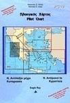
From Rio-Antirrio Bridge up to Corinth Isthmus
Includes: Northern coasts of Peloponnese, Alkyonides Gulf, Antikyra Gulf, Krissaios (Itea) Gulf, N. Trizonia
Language: Greek and English
Size (unfolded): 100 x 70 cm
Specifications are collected from official manufacturer websites. Please verify the specifications before proceeding with your final purchase. If you notice any problem you can report it here.